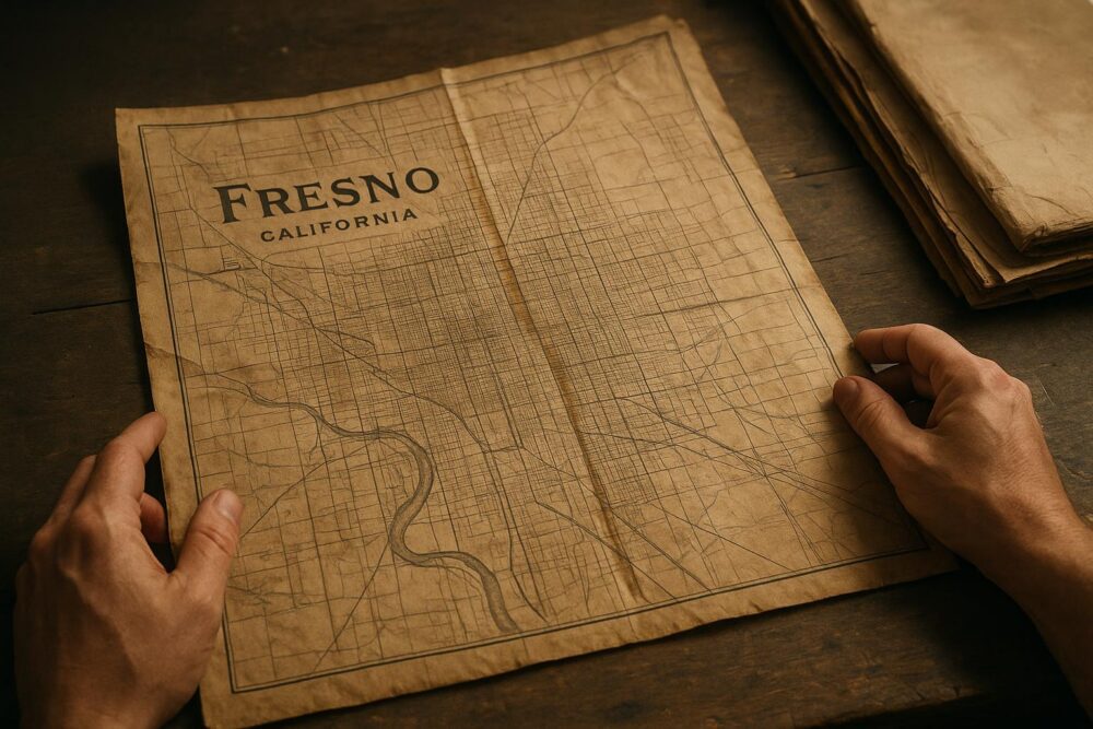
They were stacked in flat wooden crates, wrapped in brown paper and bound with twine, the kind of boxes you expect to hold ledgers or fragile blueprints. Instead the county archvie intern pulled out sheets that had been mothballed for a century: large, hand-colored plans of streets, lots, canals and rail spurs. The lines were astonishingly crisp. The ink held. Small pencil notes in the margins hinted at negotiations over land and water that shaped Fresno’s growth.
## Historic Fresno City Maps 1900s Rediscovered In County Archive
Most of the maps date from the first three decades of the 1900s. They include Sanborn-style insurance maps, detailed cadastral plats showing owners’ names, and municipal planning sheets where engineers penciled in proposed sewer lines. The find matters because few collections of this scale have survived in Fresno. For anyone tracing property, tracking infrastructure or trying to imagine the old city at street level, these historic fresno city maps 1900s are a goldmine.
The crates seemed to have been misfiled during a move in the 1970s. An index card labeled “misc. plats” sat on top of one box. It took a week of gentle unfolding and flattening to be sure of what the researchers had — and to start the long process of conservation.
### Condition And Dating
Paper quality varies. Some sheets are rag paper, thick and fibrous, and those are in the best shape. Others are thin, machine-made sheets that have browned at the edges. Stamps and ledger marks pin most of the maps to specific years. Engineers wrote dates in small script: 1902, 1908, 1915. Several maps were revised repeatedly; you can see inked-over streets where roads were widened, and compass roses annotated with different magnetic declination notes.
The handwriting helps too. Certain surveyors left characteristic loops on capital S’s and distinct numeral 7s. Matching these handwriting traits to other public records let archivists place maps more precisely. These are not generic reproductions. They are working documents from planning meetings, legal disputes and industry requests.
### What The Maps Reveal
At first glance the maps confirm what older photographs show: a modest downtown grid, a few rail lines and clusters of dense wooden buildings. Look closer and details pop out. Alleyways existed where we now have wide boulevards. A branch of the Southern Pacific cuts a different diagonal than the modern right-of-way. Irrigation channels that once braided the flats are mapped as permanent features; they intersect streets in ways that explain odd property lines and strange backyard elevations still visible today.
Neighborhoods that locals know by name appear with different boundaries. One map labels an area near Fresno Street as “Italian Market.” Another, only a few years later, shows that same block relabeled as a planned school site. The maps document not only built forms but social shifts.
Historic markers change, too. Where the current map lists a park, the 1900s maps sometimes show a cemetery or a brick kiln — uses that modern development erased. For researchers, these maps are a layer of memory that connects place names to land use. The discovery has already sparked projects to reconcile property deeds with what the maps show.
#### Key Landmarks And Oddities
– A shaded triangular lot east of the courthouse annotated “Coal Shed” with an arrow pointing to a spur.
– A small creek labeled “Arroyo” running through what is now a municipal lot; later maps show it routed underground.
– Streets renamed without public notice; one sheet lists Central Avenue as “Hoyt” in a hand that predates city renaming records.
– Block numbers that don’t match modern parcels, causing a few genealogists to rethink family home locations.
Those details make the old maps more than curiosities. They explain why a 1910 tax roll lists a property differently from a 1950 assessor map. They show patterns of industrial encroachment and residential retreat. People using old fresno maps will find answers to questions they didn’t realize they had.
Historic Fresno City Maps 1900s Unearthed In Archive
## How Researchers Are Putting The Maps To Work
Genealogists flock to documents that tie a name to a place. Urban designers want to know past street cross-sections to inform restoration of historic corridors. City attorneys look at original platted easements when utility disputes arise. The newly found cache has drawn all three groups.
One immediate application is flood mitigation. The irrigation and drainage features on the fresno maps 1900s show historic flow routes that modern storm systems sometimes re-open in heavy rains. Knowing where water ran a century ago helps engineers plan greenstorm infrastructure and avoid surprises when trenched pipes unexpectedly hit old culverts.
Historians are using the maps to reconstruct ethnic neighborhoods and business districts. For instance, a cluster of small lots filled with tiny dwellings and annotated vendor stalls corresponds to early 20th-century immigrant neighborhoods documented in newspapers. Combining these maps with census records clarifies who lived where and how communities dispersed over time.
### Technical Steps For Preservation
The archive prioritized digitization, but not before stabilizing the sheets. Books and maps with brittle edges received humidification and gentle flattening. Tears were mended with Japanese tissue and wheat paste where appropriate. The conservation team avoided over-restoration; the goal was access, not to make everything look new.
Digitization uses high-resolution scanners and a careful, color-calibrated workflow. After scanning, teams georeference the maps — aligning old paper coordinates with modern spatial data. That process corrects for historical shrinkage and warped edges. Once georeferenced, the maps can be overlaid onto current satellite imagery. Researchers can toggle between 1900 and 2020 layers to see change in real time.
Georeferencing also enables searchable features. You can query for “rail line” or “school” and find the map tiles where those labels appear. That capability transforms a fragile stack of paper into a living dataset.
### Access And Community Engagement
The archvie plans to release a browsable portal late this year. Before that, a series of community digitization workshops will invite volunteers to transcribe marginal notes and index owners’ names. Local historians will help verify place names and identify buildings. That participatory approach speeds up the cataloging and keeps the material grounded in local knowledge.
Physical access will remain controlled because many sheets are fragile. However, the archive is scheduling viewings by appointment and has designated several hardy sheets for a rotating public display. If you’re a homeowner tracing a lot line or a student working on a neighborhood study, the portal will be your first stop; an appointment will get you to the originals if you need them.
## What To Watch For Next
Expect a string of smaller projects to spin out of this find. Placemakers will use maps to argue for restoring historic streetscapes. Environmental planners will mine irrigation data to model subsidence. Historians will publish microhistories that link a single parcel to waves of migration and commerce.
There’s also a chance these maps will change practical outcomes: in one case, an original easement shown on a 1906 plat could affect a current development’s setbacks. The archive’s legal team is already fielding calls from surveyors wanting certified copies. That’s the tricky part of working with century-old documents — they’re romantic and technical at the same time.
If you want to follow the project, the archive has a mailing list and is hosting a mapping day where community members can help tag businesses on scanned sheets. It’s a hands-on way to learn the spine of the city and to see how streets you pass every day evolved from irrigation ditches and rail spurs into the neighborhoods you know now.
One map shows a trolley line that used to connect the city center to a cluster of orchards. Walk that route today and you’ll cross shopping centers and apartment blocks. Yet on paper, the line marks a rhythm of stops and small businesses, a snapshot of daily life that would be easy to miss without the map. Those are the moments that make these historic fresno city maps 1900s more than archival fodder; they reanimate the lived city.