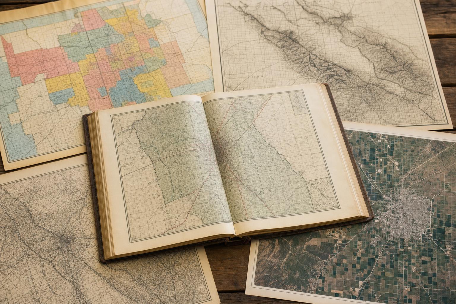
## Using Fresno County Property Atlas Historical Maps For Research
Old maps are stubbornly useful. When you pull up a set of fresno county property atlas historical maps you get more than lines and labels: you see who owned what, where irrigation shifted, and how towns like Fresno, Clovis, and Sanger spread outward. These maps are not museum pieces. They’re working documents for surveyors, historians, planners, and homeowners trying to trace property lines back to a 19th-century patent.
### What Those Maps Actually Show
The earliest sheets in many collections are plat maps and assessor’s plats. They mark parcels, owner names, and township-range numbers. Later editions add roads, rail spurs, and sometimes irrigation ditches. A mid-century sheet might show an orchard layout; a modern reprint will have parcel IDs used by the county assessor. If you need to confirm a deed description or find the exact location of an old building foundation, these pages often tell you the coordinates you’ll need.
If you’re using a digital viewer, overlays can make the changes obvious. Zoom between a 1930s aerial and a 1970s parcel map and you’ll watch orchards become subdivisions. That’s why many people consult the fresno county property atlas historical maps when a development question turns contentious: they make historical land use legible.
### How To Access The Fresno County Atlas Collections
Public libraries, county recorders, and local historical societies keep physical copies. Many counties have scanned their holdings, so you can search online. If you want one-stop browsing, check the county assessor’s GIS portal or the university map library collections. The fresno county atlas archives are increasingly searchable by owner name, parcel number, or year — which saves a lot of legwork.
If the map you need isn’t digitized, plan a visit. Bring a copy of the current parcel map and a notepad. Photos are usually allowed. Ask staff about scale and printing sizes; large-format maps lose detail when photocopied at the wrong scale.
#### Practical Tips For Reading Old Parcels
1. Start with the township-range grid. It frames everything.
2. Compare owner names across editions to follow transfers.
3. Look for printed notes: easements, right-of-way, and floodplain markings are often tucked in margins.
4. Cross-check road names. Many local roads were renamed or realigned decades ago.
One more tip: don’t assume colors mean the same thing across years. Color conventions shifted. Treat them as hints not rules.
### Uses Beyond Property Lines
People come to the fresno county atlas for genealogy, too. An 1880s parcel sheet listing a family name next to a homestead can unlock census records and probate files. Planners rely on the fresno atlas to understand legacy irrigation routes that still affect drainage and flood risk. Architects use old lot dimensions when restoring historic façades. Even amateur metal-detectorists use these maps to locate former farmsteads.
There are less obvious uses. If you’re trying to prove a continuous lane was once a public road, an 1890s map in the collection might show it labeled as a county road. That single detail can change a property dispute.
### Interpreting Changes Over Time
When you flip through decades of maps, patterns emerge. The Central Valley’s shift from wheat to orchards, then from orchards to housing tracts, shows up as a repeating geometry: large rectangular parcels subdivided into smaller, regular blocks. Maps also record infrastructure: railroad spurs, later removed, tell you why a town sits where it does. In Fresno County, the arrival and realignment of irrigation districts left a clear imprint across many sheets in the fresno county property atlas historical maps set.
Don’t ignore marginalia. Surveyor notes and amendment stamps often explain why a boundary was adjusted. The notes sometimes point to separate documents you’ll need at the county recorder.
### Digitization And Modern Tools
Most recent efforts focus on georeferencing old sheets so they align with modern GIS. That makes it possible to extract parcel polygons and compare them to current tax rolls. If you’re comfortable with GIS, you can overlay historic parcels on current aerials to calculate land-use change. If not, simple web tools let you toggle layers, measure distances, and save screenshots for your records.
Repositories label things differently. Search both “fresno county atlas” and “fresno atlas” when looking for digital files. The naming inconsistency can be maddening, so try both variations plus the county assessor’s parcel number if you have it.
### When You’ll Need Professional Help
Maps can be messy. Boundary lines get redrawn, legal descriptions can be ambiguous, and place names vanish. For boundary disputes or title issues, hire a licensed surveyor or a real estate attorney who reads old maps routinely. They’ll interpret subtle clues — offset lines, surrendered easements, reference corners — and point you to the right chain of records at the recorder’s office.
A single misread line can cost a lot. Don’t guess.
Keep a list of the map titles, dates, and any marginal notes you find. That log will help professionals move faster when you hand off the case. And if you get stuck hunting for a scanned copy, ask local historical societies: they often hold unique prints not available online.
Now dig in. The fresno county property atlas historical maps show a county that kept changing, sometimes in neat patterns, sometimes in messy bursts. They’ll teach you more than where a line runs. They’ll tell you why.